
By NASA
January 27, 2022
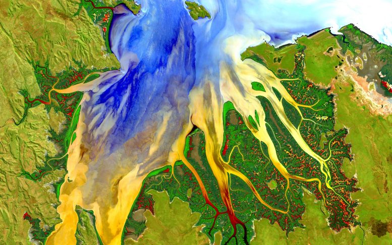
Western Australia caught by the Landsat 8 satellite on May 12, 2013. Credit: NASA/USGS Landsat; Geoscience Australia
This NASA picture of the day, captured by the Landsat 8 satellite, shows the view over Western Australia on May 12, 2013. The image reveals rich sediment and nutrient patterns in a tropical estuary location and complex patterns and conditions in vegetated areas.
The image is improved and involved masking, individually enhancing, and then reassembling water and land parts of the image. The water patterns are the result of an RGB display of Landsat-8s red, blue, and ultra-blue bands. Land is shown using short-wavelength-infrared, near-infrared, and green.