
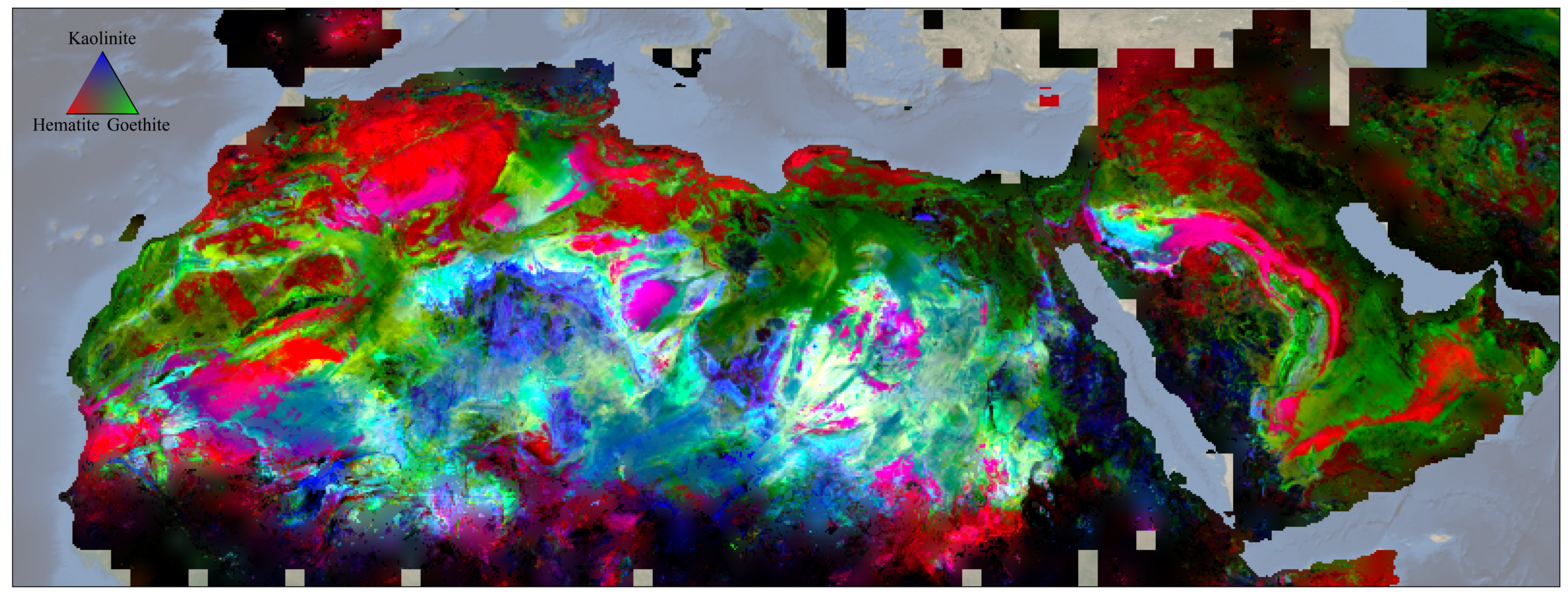
NASA’s EMIT mission has just created the first comprehensive mineral map in the world’s dusty regions. The global map provides the precise locations of 10 key minerals based on how they reflect and absorb light.
- 🌍 A NASA satellites provides an unprecedented view of Earth, mapping surface minerals in arid regions and aiding in environmental monitoring.
- 🔍 Utilizing a variety of wavelengths, EMIT can identify specific minerals like hematite and kaolinite.
- 🌱 This comprehensive mapping is also useful for climate mapping, as these minerals interact with sunlight.
Satellites can truly revolutionize our understanding of the planet. The first step was acquiring visible data, and this data is used in a number of applications. These satellites provide a bird’s-eye view of Earth’s landscapes, enabling scientists to monitor changes in vegetation, land use, and environmental conditions. They can detect deforestation, desertification and changes in ecosystems. Satellites with visible light sensors can also capture images that help meteorologists track weather systems.
The next step is using more than just visible light. By using different wavelengths, scientists can figure out what a certain surface material is. Is it vegetation, pollution, or perhaps a specific mineral?
That’s exactly what NASA’s EMIT mission does. It looks at arid (desert) regions in the world where the wind blows particles into the air. Some mineral dust absorbs more sunlight, while others absorb less. EMIT maps these regions, providing the precise locations of 10 key minerals including hematite, goethite, and kaolinite.
The mission has so far mapped some 55,000 “scenes” — with one scene being a 50-by-50-mile (80-by-80-kilometer) image of the surface. This is enough to create a detailed map of the surface composition of minerals in virtually all arid regions of the planet.
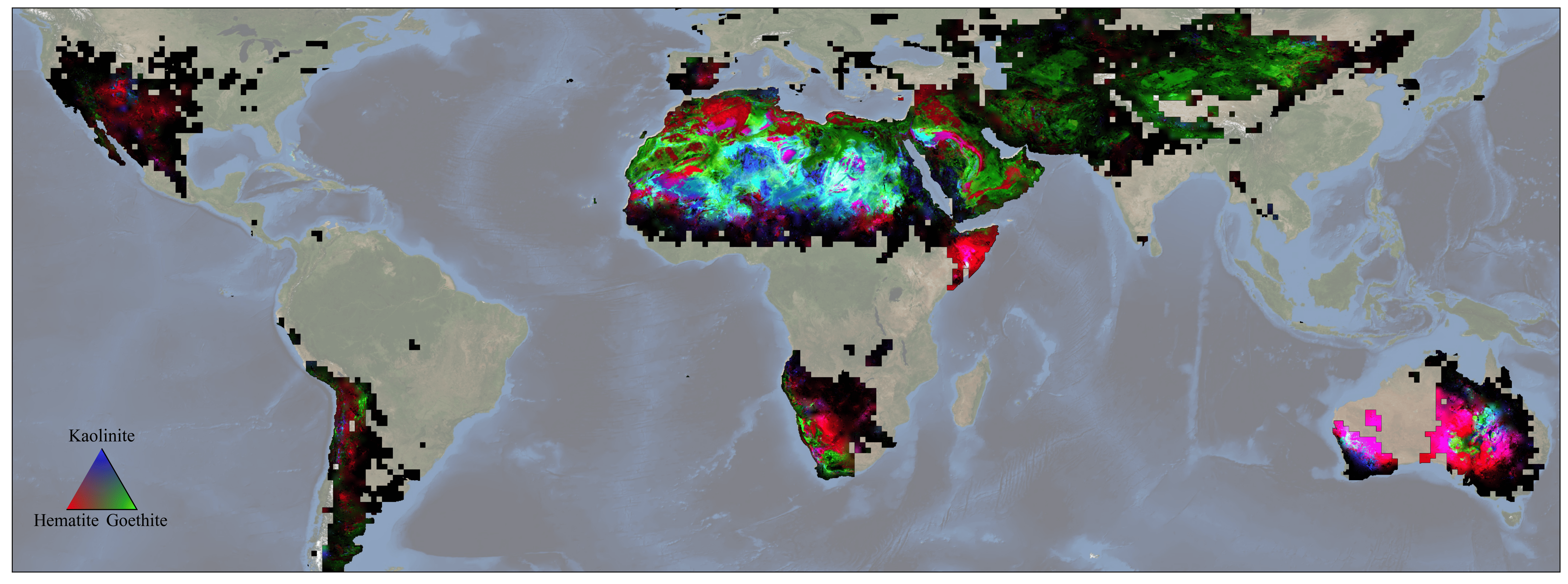
“To this point we simply haven’t known the distribution of surface minerals over huge swaths of the planet,” said Phil Brodrick, a JPL data scientist who spearheaded the creation of the mineral maps. With the EMIT data, “there will likely be a new generation of science that comes out that we don’t know about yet, and that’s a really cool thing.”
This information is useful for a number of applications, including climate studies. These minerals can play a significant role in warming and cooling our planet. If researchers can understand how they’re distributed on the planet, they can create better climate models.
“We’ll take the new maps and put them into our climate models,” said Natalie Mahowald, EMIT’s deputy principal investigator and an Earth system scientist at Cornell University in Ithaca, New York. “And from that, we’ll know what fraction of aerosols are absorbing heat versus reflecting to a much greater extent than we have known in the past.”
This isn’t the first time surface minerals have been mapped from outer space, but it’s the most comprehensive image by far.
“Wherever we need chemistry to understand something on the surface, we can do that with imaging spectroscopy,” said Roger Clark, an EMIT science team member and senior scientist at the Planetary Science Institute in Tucson, Arizona. “Now, with EMIT, we’re going to see the big picture, and that’s certainly going to open some eyes.”
This information can be used for other applications as well. For instance, dust from these minerals can affect ecosystems. In particular, they can trigger phytoplankton blooms, which are important for local ecosystems as well as the planet’s carbon cycle.
To make things even better, this is just one of EMIT’s capabilities. The mission has also demonstrated the ability to detect plumes of methane and carbon dioxide being emitted by landfills, oil facilities, and other infrastructure.