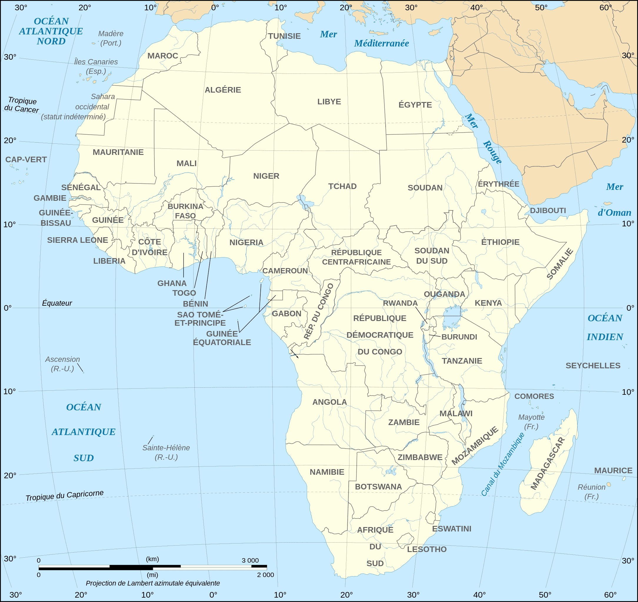
Pull out a map of Africa and you’ll notice awfully many suspicious straight lines, right angles, and diagonals. Many people were taught in school that the borders of African states look like this because that’s just how the colonial powers drew them, arbitrarily dividing the territories among themselves. It’s mighty reminiscent of how states in the U.S. are separated, but that’s a different colonial story for another time.
Imagine a gang of old white men with beards and top hats, a cigar in one hand and a ruler in the other, bickering one evening over who gets what. That’s sort of the mental picture conjured by this tragic partitioning. It may sound farcical, but there are real and deep-seated consequences to this partitioning that are felt to this day, as many ethnic people found themselves in a different country overnight. Wars have been fought over this, sometimes leading to genocide.
But this picture isn’t entirely accurate. A new study by political scientists from Emory University, Washington University, and Loyola University challenges the conventional wisdom that Africa’s international borders were drawn entirely arbitrarily by European colonial powers. Instead, it argues that border formation in Africa was a dynamic process influenced by on-the-ground realities, particularly precolonial political frontiers and major geographical features.
What’s the real story of Africa’s borders?
Despite Europeans’ limited knowledge of Africa when most current international borders on the continent were established at the Berlin Conference in 1884-85, evidence suggests they nevertheless made some effort to sketch them out sensibly. This was not out of compassion for the people of Africa or out of some sense of foresight that doing otherwise would escalate tensions. Naturally, it was out of practical self-interest.
In order to maximize their territorial acquisition and access to resources, powers such as Great Britain, France, Germany, and Belgium, all sent delegates to secure treaties from indigenous peoples or their supposed representatives. They also examined local conditions such as rivers and terrain, as well as historical state frontiers, the researchers wrote. This means that Africans, or at least their leaders, were more involved in influencing the border formation process than most people think.
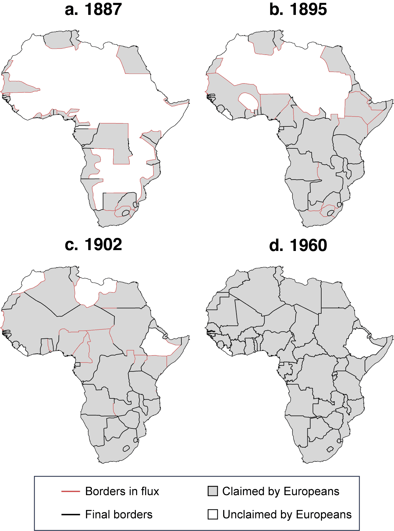
The authors used two original datasets for a quantitative analysis of African borders. They employed grid cells to statistically analyze the likelihood of border segments coinciding with rivers, lakes, and the frontiers of pre-colonial states. This analysis reveals that borders are more likely in areas associated with these features. For instance, major water bodies were often used as focal points for borders, and straight-line borders were mostly confined to areas lacking discernible local features.
They also performed a qualitative analysis, compiling treaties, diplomatic histories, and causal process observations for every bilateral border. They found evidence that historical frontiers directly influenced the location of many African borders later established by Europeans.
Overall, the study found that historical political frontiers directly impacted 62% of all bilateral borders. This indicates that European powers, while pursuing their territorial ambitions ruthlessly, often respected existing political and territorial boundaries to some extent.
The complex partitioning problem
Despite finding that Africa’s borders were not arbitrary, or at least not entirely so, the researchers acknowledge the important social consequences of colonial partitioning.
“African colonial borders are less aligned with ethnic geography than borders elsewhere, and they frequently dismembered ethnic and cultural groups across international boundaries. Such borders, even when they incorporated local features, clearly created deleterious human consequences. Our contribution with regard to dismemberment is to demonstrate that which groups were partitioned followed a systematic process, contrary to existing assertions.”
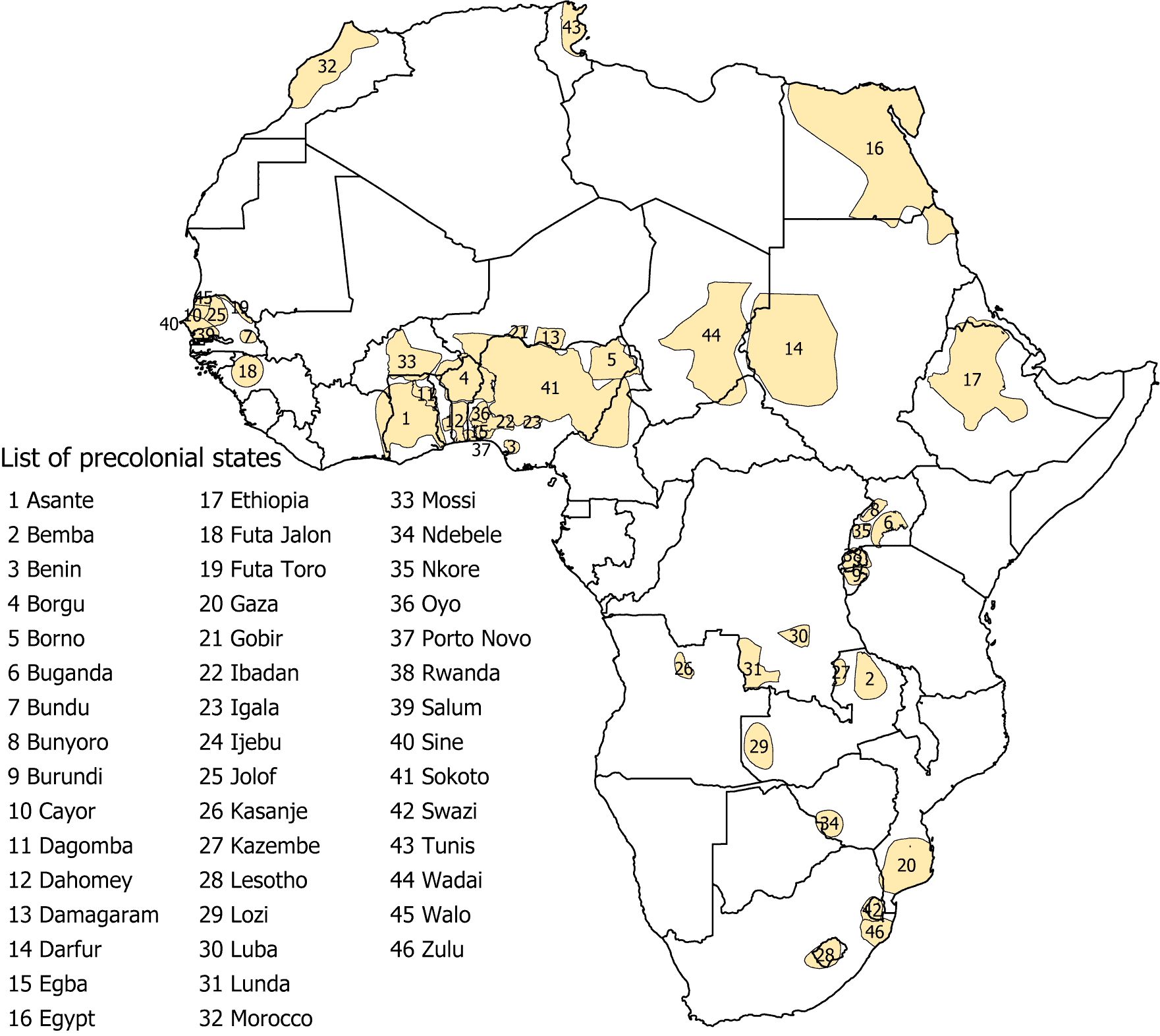
“Areas with precolonial states were rarely dismembered because incorporating their territorial limits created an agreed-upon method for self-interested Europeans to allocate territory. Furthermore, frequent migration and intermingling among peoples of different ethnicities, cultures, and languages ensured that any regional system that enshrined fixed territorial borders would divide groups with fractured polities or decentralized institutions,” the authors wrote in American Political Science Review.
The researchers make another important point. They argue that pre-colonial states, often divided into small tribes, were too small in both size and number to form the basis of the colonial and later post-colonial African states we see today. Even if the European powers had ‘drawn’ the borders with more consideration, that still wouldn’t have solved the many problems and negative consequences we see today.
“The conventional wisdom on Africa’s “bad borders” suggests the following counterfactual: taking as given the general contours of the European colonial occupation and externally created states, certain negative outcomes would have been less likely if Europeans had been more conscientious when determining the location of borders. Our evidence suggests strongly that this counterfactual is wrong. Imposing any set of fixed borders would have suffocated precolonial states within larger colonial states (at least without creating hundreds of states) and dismembered decentralized groups.”
“Although colonial states in Africa were largely artificial with respect to historical antecedents and geographic considerations, the borders between these states were not. Africa’s borders reflect a negotiated and systematic process that scholars and popular accounts have largely overlooked and misunderstood.”
Thanks for your feedback!