
The ground penetrating radar onboard the Perseverance rover on Mars has offered an unprecedented view of the sediment in the Jezero Crater that the rover is exploring. The data hints at a lake with a delta-type environment and a river feeding all of this. In fact, by looking at the radar signal from the subsurface sediment, researchers also have an idea of how this lake evolved — and ultimately disappeared.
Water on Mars
Jezero Crater is a 28-mile wide depression on Mars. Researchers believe it was once flooded with water, so this crater may hold the key to understanding the Martian climate and potential for life. This is why it was chosen to be the exploration site for NASA’s Perseverance rover.
Perseverance doesn’t only look at things visually — it also has a suite of scientific instruments to explore both the surface and the subsurface of Mars. At the heart of this exploration is an instrument called RIMFAX — Radar Imager for Mars’ Subsurface Experiment. This instrument sends out radar pulses that penetrate the Martian surface, offering a never-before-seen glimpse into the geological layers beneath.
“From orbit we can see a bunch of different deposits, but we can’t tell for sure if what we’re seeing is their original state, or if we’re seeing the conclusion of a long geological story,” said David Paige, a UCLA professor of Earth, planetary and space sciences and first author of the paper. “To tell how these things formed, we need to see below the surface.”
Finding a delta
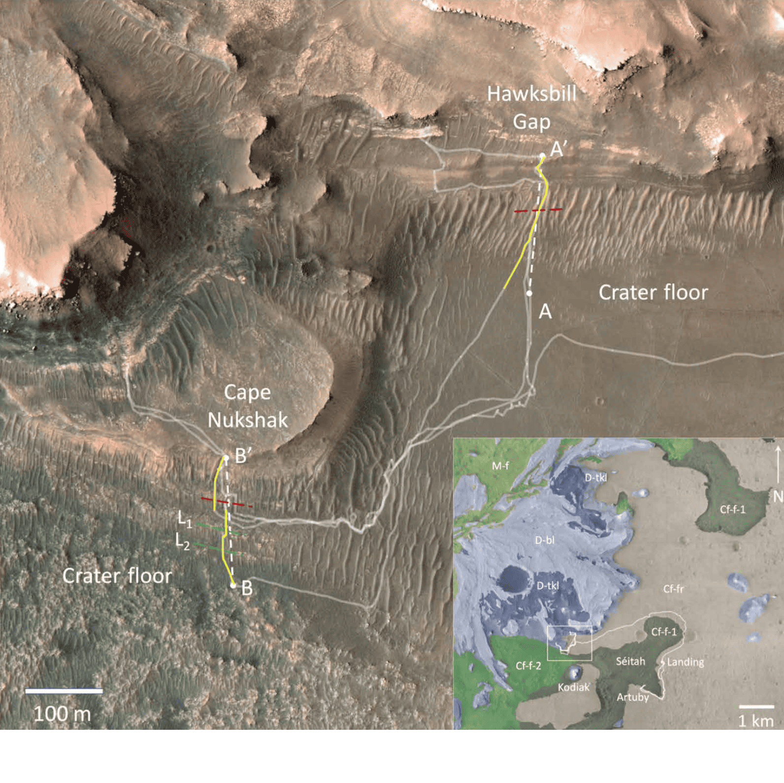
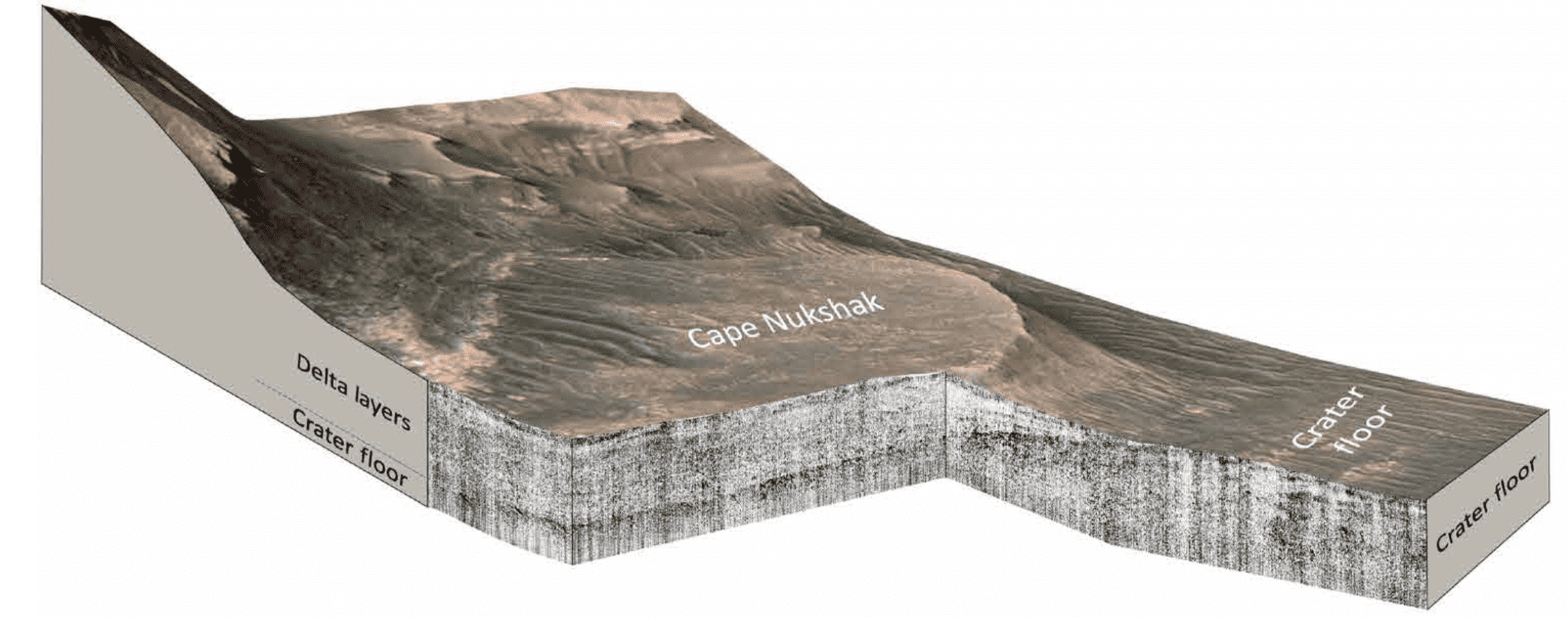
Between May and December 2022, Perseverance drove around the Jezero Crater, exploring an area of 3-billion-year-old sediment that seemed to resemble the deltas from Earth. RIMFAX fired radar pulses at 10 cm intervals, penetrating to a depth of around 20 meters below the surface. Every time the pulse would encounter a different layer, a part of its energy would be reflected back to the surface. From that reflection, researchers can analyze the structure and some parameters of the subsurface sediment.
Their conclusion?
“The delta deposits in Jezero crater contain sedimentary records of potentially habitable conditions on Mars,” the researchers note in the study.
The radar data imaged two periods of sediment deposition, sandwiched between two periods of erosion. These findings suggest a low-energy lake environment, where calm waters allowed fine sediment to settle over time. This tranquil setting might have been conducive to life, offering a stable habitat with water and potentially life-supporting nutrients.
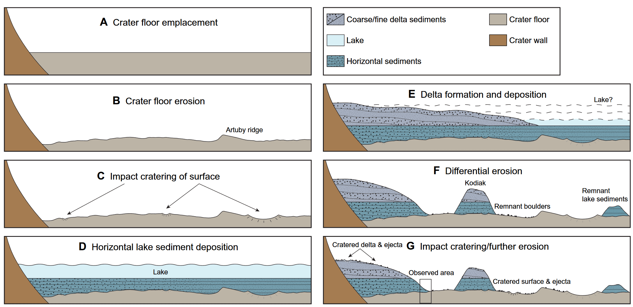
The sediments are horizontal and on the radar data appear strikingly similar to what you’d see on a delta deposited on Earth. This is exactly what scientists were suspecting but was unconfirmed until now.
“The changes we see preserved in the rock record are driven by large-scale changes in the Martian environment,” Paige said. “It’s cool that we can see so much evidence of change in such a small geographic area, which allows us extend our findings to the scale of the entire crater.”
In time, the lake dissipated and left the geological features we see today. But all this adds to the evidence that Mars of the past was very different from what we see today; this Martian past would have checked a lot of the boxes that make a planet habitable.
Ultimately, this glimpse into Mars’ aqueous past not only enhances our understanding of the planet’s geological and hydrological history but also reignites the possibility of signs of microbial life that may be discovered on Mars (whether it would be active or fossilized remains to be seen). As we continue to analyze these discoveries, the future of Martian exploration looks promising, potentially unraveling more secrets of our enigmatic neighbor in the solar system.